102 18 Street NW
Community
Hillhurst
Address
102 18 Street NW
Landowner
630052 Alberta Ltd.
Project Team
Prospect Studio Urban Planner & Engagement Lead
Inertia Architect
Site Context
Site Context Figure
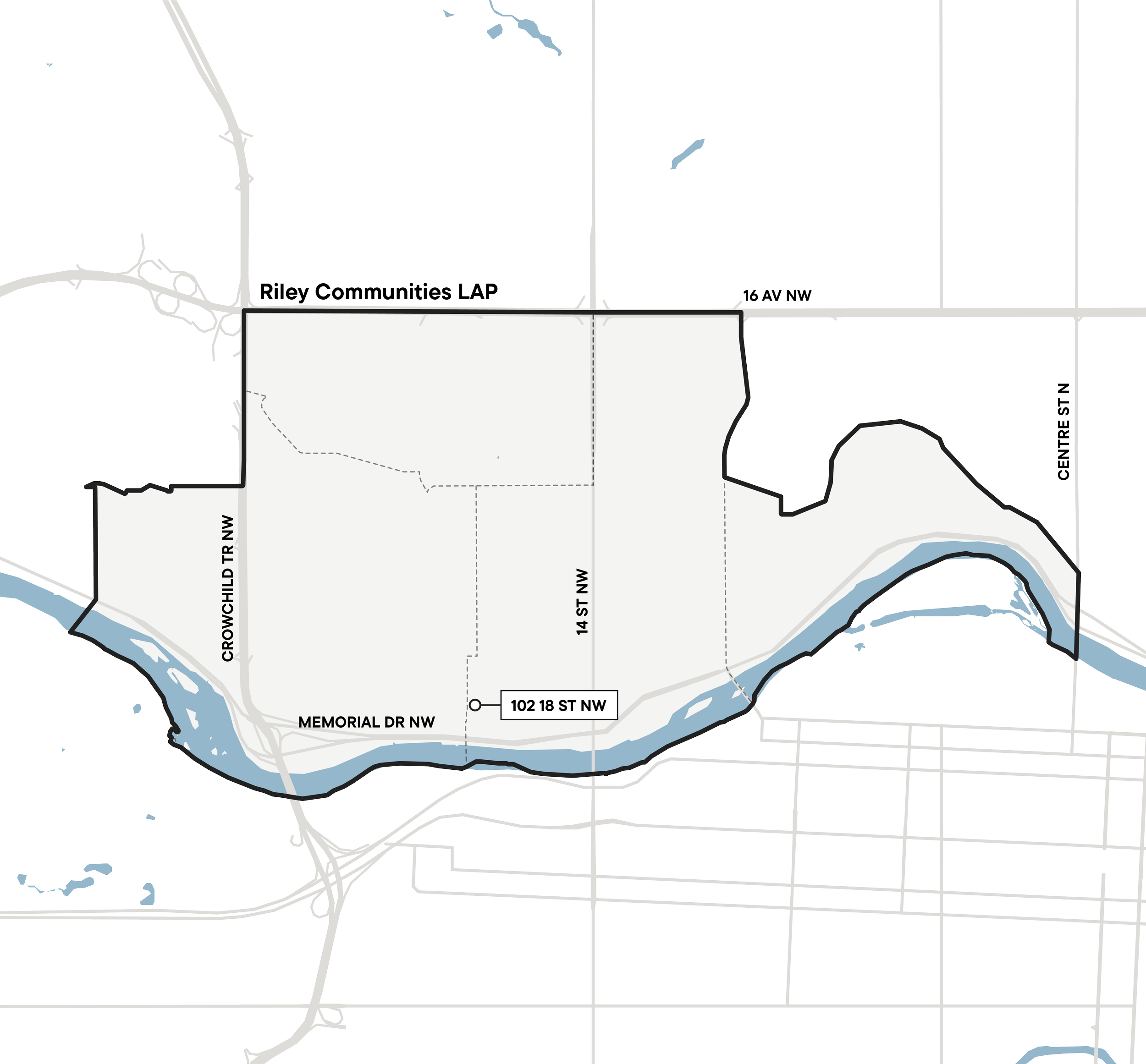
The site is located in Hillhurst, an established inner-city community on the north bank of the Bow River, along its border with West Hillhurst. Sitting on the corner of Kensington Road NW and 18 Street NW, the project will add new homes in a walkable and amenity-rich area. Residents will be steps from the shops, restaurants, and services of the Kensington Road NW Main Street, and a short walk from the 19 Street NW Community Corridor (±250m), the 14 Street NW Main Street (±500m), the Bow River Pathway, and the Hillhurst Sunnyside and West Hillhurst Community Associations. SAIT is ±2.2km away, about 14 minutes by bike or 20 minutes by transit, and the University of Calgary is ±4km away, about 20 minutes by transit or bike.
The site is well connected by multiple modes of transportation. Kensington Road NW is a designated Neighbourhood Main Street and part of Calgary’s Primary Transit Network, integrating local business activity with walking, cycling, and transit, with Local Transit Route 1 just a ±1 minute walk from the site. These options make it easy for residents to choose walking, cycling, or transit for their daily needs, supporting more active and vehicle-optional lifestyles.
Development Vision

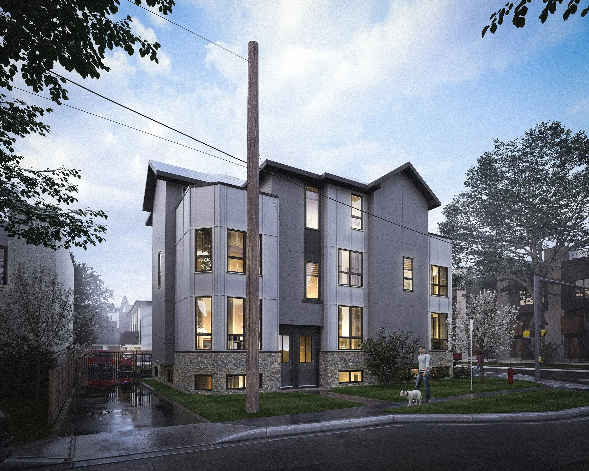
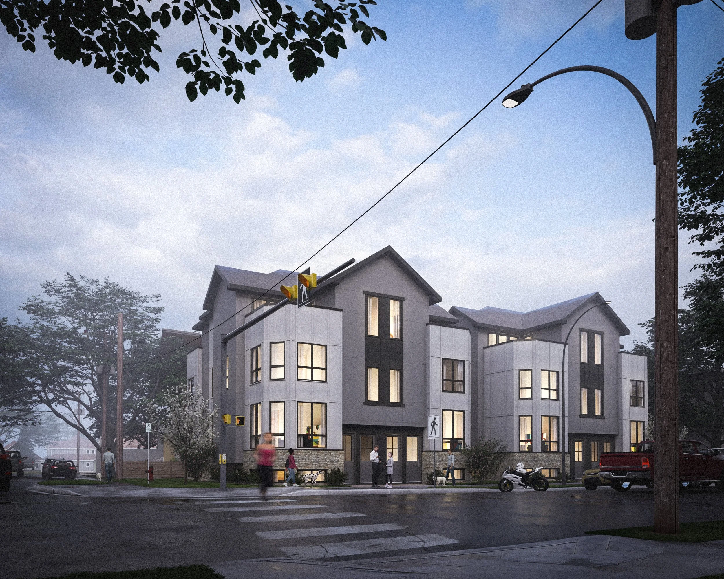
The project is envisioned as two 3-storey grade-oriented residential buildings on a corner site at 102 18 Street NW in Hillhurst, at Kensington Road NW and 18 Street NW. It will add 10 new homes, including 5 residential units and 5 secondary suites, offering a wider range of housing options in an established community close to transit, the Kensington Road NW Main Street, SAIT, and the University of Calgary.
The project is designed with its surroundings in mind. The site is immediately adjacent to existing multi-residential housing along 18 Street NW and Kensington Road NW, and the proposed 3-storey form provides a complementary transition between surrounding buildings. Its corner location provides double street frontage onto Kensington Road NW, a higher-activity street with correspondingly higher levels of transit, vehicle, and pedestrian activity.
The project includes 5 surface vehicle stalls accessed from a driveway off 18 Street NW, meeting Land Use Bylaw requirements, as well as 14 bicycle stalls (10 Class-1 and 4 Class-2), exceeding Land Use Bylaw requirements and supporting active and sustainable transportation choices.
By adding a range of homes in a compact, transit-connected location along Kensington Road NW, the project reflects the principles of complete communities and offers Calgarians at every life stage new options to live in Hillhurst.

Site Area
±0.17 ac / ±0.07 ha

Building Height
Max. 12m (3 Storeys)

Building Intensity
Max. 1.5 FAR
R-C2 to H-GO

Land Use Change
5 x Residential Units
5 x Secondary Suites

10 New Homes
5 Surface Stalls

Motor Vehicle Parking
10 Class-1 Stalls
4 Class-2 Stalls
Bicycle Parking
Conceptual Site Plan
Please note: Design is conceptual in nature and subject to change through the Development Permit application submission and review process.
Application Process
Land Use Redesignation Application
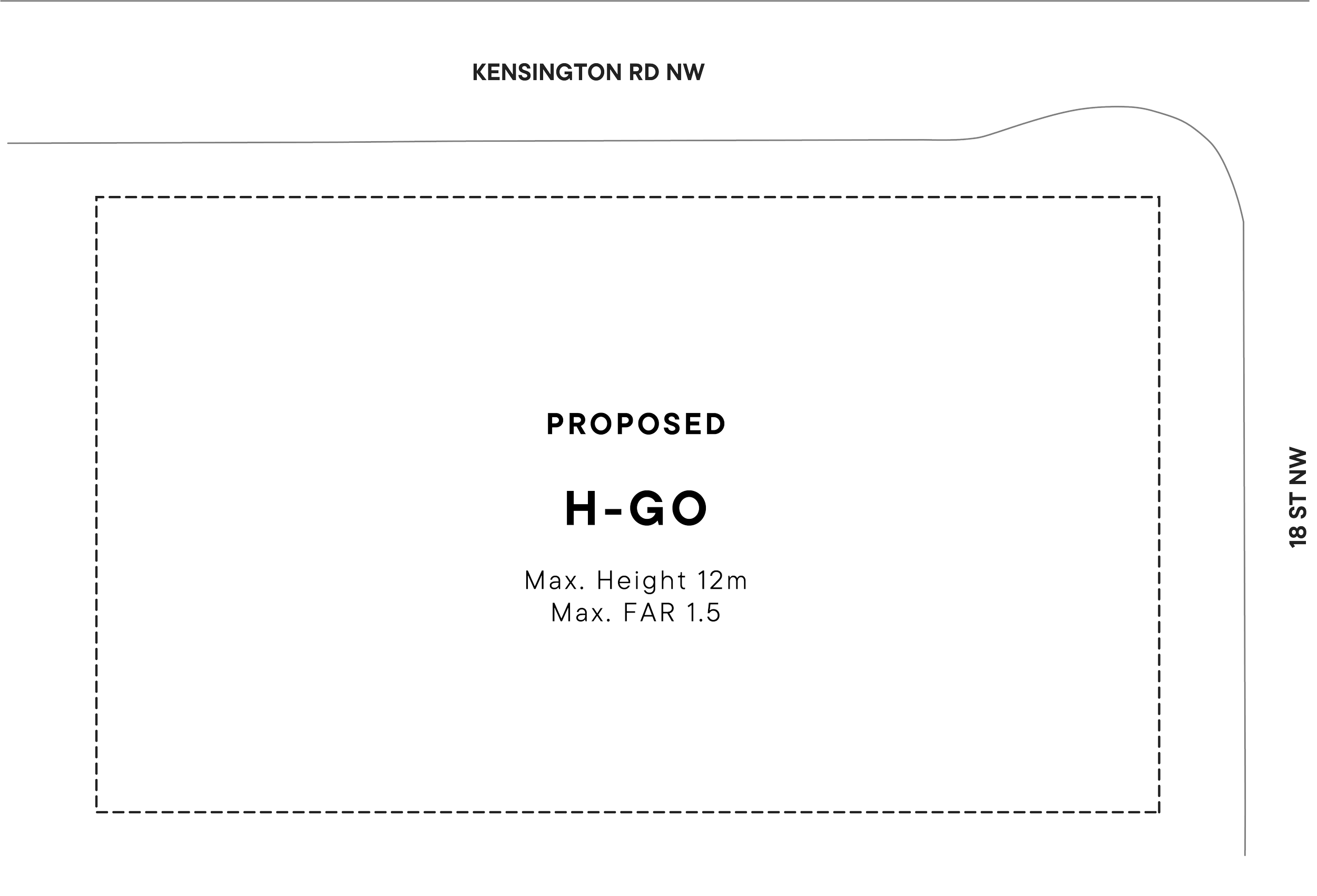
To support the development vision for this site, a Land Use Redesignation (LOC) application, also known as a “rezoning” application, has been submitted from the existing Residential – Contextual One / Two Dwelling (R-C2) District to the Housing – Grade Oriented (H-GO) District. The current R-C2 District is limited to one or two homes per parcel, such as single-detached, semi-detached, and duplex homes. The H-GO District allows a wider range of grade-oriented housing, where homes may be attached or stacked within a shared building or a cluster of buildings, at a form and scale still consistent with low-density residential districts (like R-C2). It also provides more flexible parcel dimensions and building setbacks, supporting a diversity of housing that can adapt to evolving needs. The proposed change would facilitate a 3-storey grade-oriented residential development with a maximum Floor Area Ratio (FAR) of 1.5 and a maximum building height of 12m. The site meets all of The City’s location criteria for the H-GO District, including being located along an LAP-defined Neighbourhood Connector, directly on the Kensington Road NW Main Street, and within 200m of the Primary Transit Network along Kensington Road NW.
Development Permit Application
A concurrent Development Permit (DP2026-05645) application has been submitted by the project architect, Inertia. This concurrent process allows The City of Calgary (The City) and the public to review the Land Use and Development Permit applications at the same time, ensuring a sensitive response to the surrounding site context and a clear development intent.

Riley Communities Local Area Plan
The project site is located within the boundary of the Riley Communities Local Area Plan (LAP), and falls within the “Neighbourhood Connector” Urban Form category and the “Low (up to 6 Storeys)” Building Scale category. The proposed 3-storey development is well within the scale supported by the LAP, so no amendment is required. The site is also located on Kensington Road NW, which the LAP identifies as a Neighbourhood Main Street, aligning with the LAP’s Core Values to focus growth and investment along Kensington Road NW.
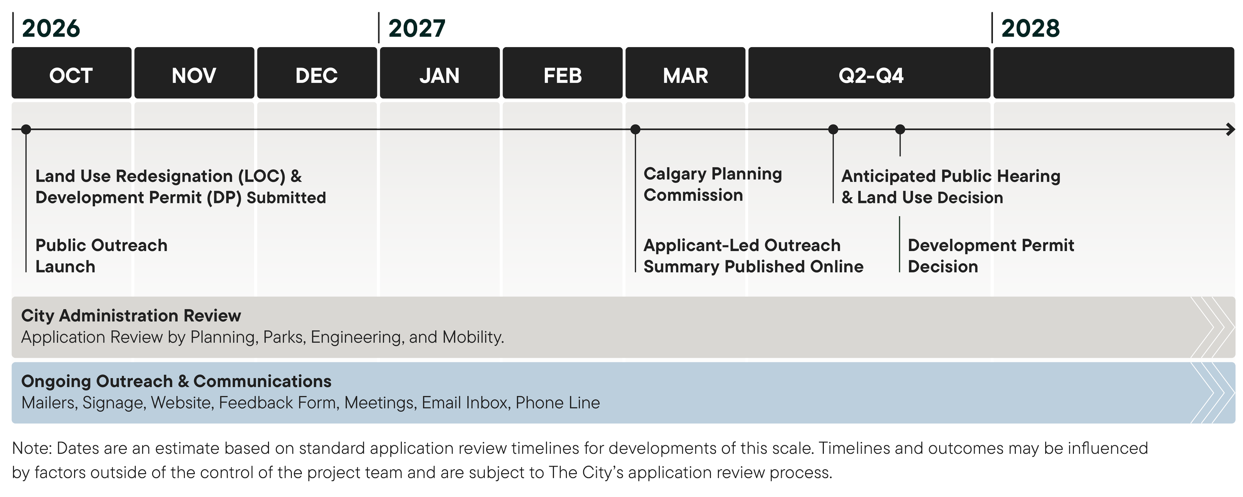
Timeline & Next Steps
Supporting Documents
For more detailed information about the proposed change and development vision, please see the supporting project documents available for download below. Please note that new documents may continue to be uploaded throughout the application process as they become available.
Get In Touch
This application is supported by this dedicated web portal, phone line, and email inbox for public questions and comments, along with custom on-site signage and project information brochures hand-delivered to residents within ±200m of the site. Key application materials are also shared directly with the local Ward Councillor’s Office and Community Associations, with opportunities to provide feedback or meet with the project team.
As our outreach process draws to a close, an Applicant-led Outreach Summary will be shared with community groups and The City and published on this website, highlighting the outreach strategies used, what we heard, and how we responded. You can share your thoughts with us directly using the contact methods below.

The City of Calgary
City Website
developmentmap.calgary.ca
Land Use Application File Number
LOC2026-0188
Development Permit Application File Number
DP2026-05645
Project Team
Email
engage@prospectstudio.ca
Phone
(587) 844-2441